The intelligence layer
for climate-resilient
African agriculture.
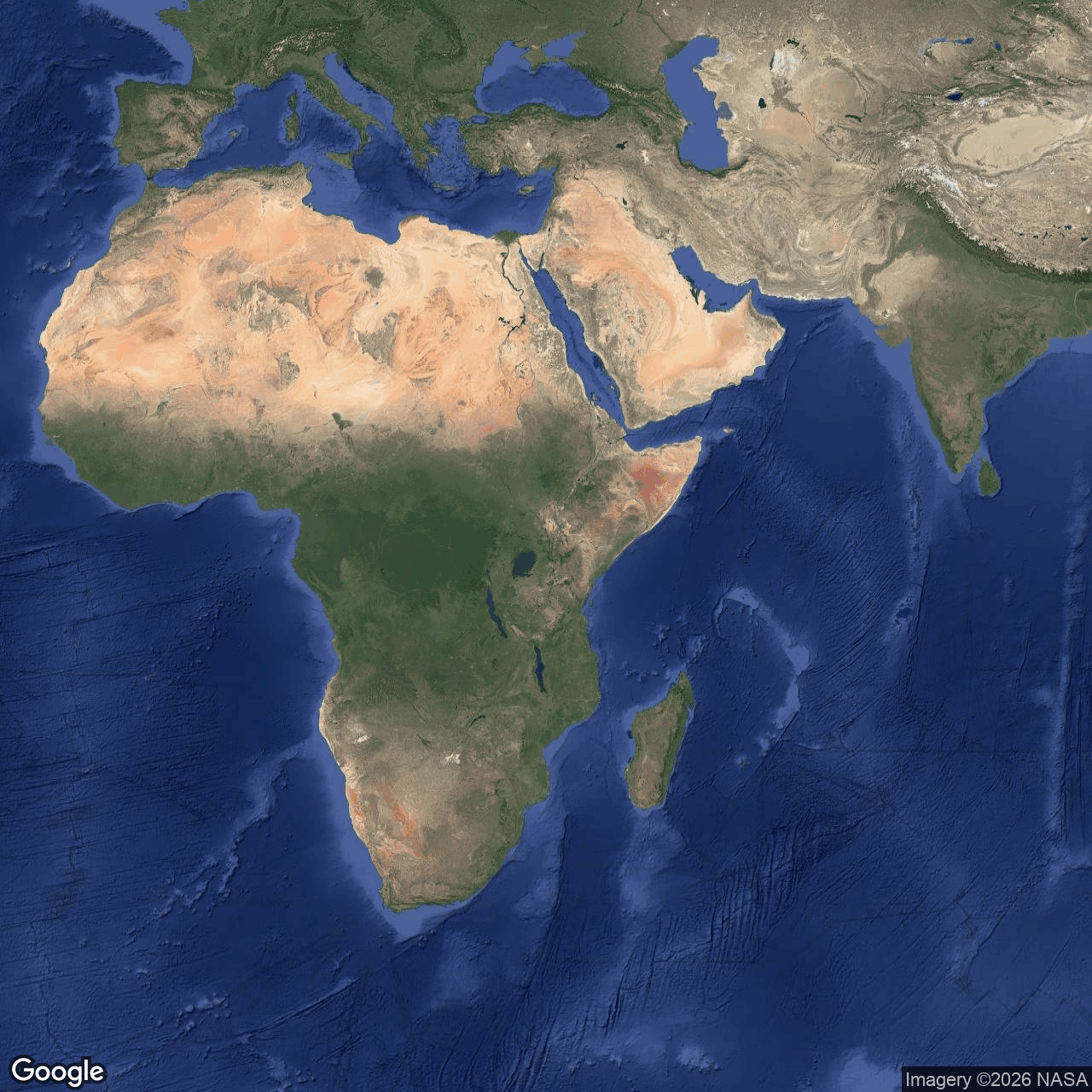
Built from mosopNandi · the highlands — a satellite-and-ground-truth fusion engine resolving the 10-meter pixel of a smallholder's plot, delivered in her dialect of Swahili before the climate event hits.
Not a farm. Not a dashboard.
Infrastructure.
The science is mature. The forecasts exist. KMD, ICPAC, GloFAS, FEWS NET — Africa's regional climate stack is real and operational. None of it reaches the smallholder at her plot, in her language, with what to do about it.
RaDa Intelligence is the cohesion layer where top-down climate forecasts meet bottom-up ground truth at 10-meter pixel resolution. Every observation a farmer logs becomes a labelled training point that sharpens our understanding of her plot. The data is ours to model with — never sold, never brokered.
Predictable agriculture begins with predictable knowledge of the field. We build the system that delivers it: a satellite-to-field operating layer calibrated by African farmers, operated under Kenyan jurisdiction, designed for African connectivity reality. The Tu-RaDa app is free for the farmer and stays that way.

Where AI infrastructure meets the African smallholder.
Generic AI fails in African agriculture because it lacks labels. We don't have that problem — we built the labelling system.
Five continental data streams, one ground-truth engine. Sentinel-1 SAR pierces cloud. Sentinel-2 optical reads canopy. CHIRPS settles the rainfall record. ERA5 holds the climate state. SRTM and ISRIC SoilGrids define the terrain and the soil beneath it. Every signal is anchored to the 10-meter pixel.
24 months of memory per farm. Biweekly autonomous refresh. Vertex AI training on 171,000+ pixel-time observations and 38,000+ ground-truth labels. Spectral early-stress detection surfaces compounding damage 5+ days before it is visible to the eye¹. The model gets sharper with every farm walk a Kenyan smallholder logs.
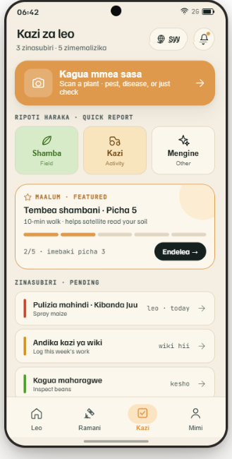
Two faces, one farmer. Tu-RaDa speaks to her in four registers of Swahili. Aegis closes the calibration loop with the agronomist on the ground. The app is free; the data is what RaDa Intelligence learns from. Every observation sharpens the model that lands back on her phone the next time the satellite passes.
¹ Hatfield et al., Agronomy Journal 2008 · Zhang & Kovacs, Precision Agriculture 2012.
Swahili-first. Offline-capable.
Free for the farmer.
Western precision-ag platforms assume always-on connectivity and 100-hectare farms. We assume neither. Tu-RaDa runs on 2G and 3G handsets, works offline, and speaks four Swahili registers — Standard, Mwananchi (Deep Kenyan), Komrad-Sheng, and Rasmi (Official) — because farmers pick the register that matches how they actually talk.
Every farm walk she logs, every photo she takes, every disease check she confirms becomes a labelled training point. The product is the calibration engine.
If you can't see the row,
you can't manage the resource.
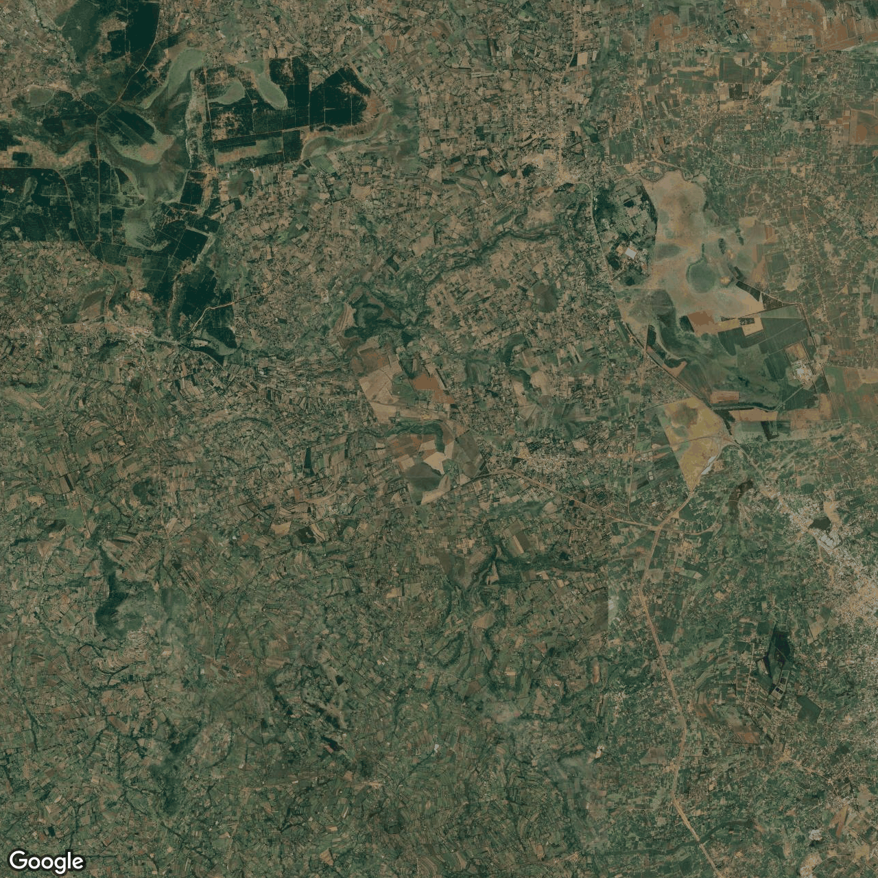
10m field-level colour
The standard product. The whole field looks fine. The two rows where pests broke through are invisible at this resolution.
30cm synthetic resolution
The same field, resolved to the row. Two stressed rows surface — and surface five days before the loss is visible from the ground.
Built in Kenya. By a Kenyan.
Calibrated by African farmers.
Africa is the most climate-vulnerable continent and home to most of the world's growing smallholder farming population. The agricultural intelligence layer that closes the gap between climate science and the smallholder's plot is not a luxury — it is the prerequisite for SDG 2, SDG 13, and Agenda 2063.
No external actor will build this layer for African farmers at the resolution they need. It has to be built by Africans, calibrated by African farmers, deployed first across African geographies, and operated under African legal jurisdictions. That is what RaDa Intelligence is — by structure, not by branding.
From mosop — the Nandi highlands.
RADA SAT SVC LTD incorporated in Eldoret in 2023. Validation farm operating in Uasin Gishu since 2021. The founder's family roots reach into the same county the system is calibrated against. Read more →
Designed for African reality.
Tu-RaDa works offline on 2G and 3G handsets. Four Swahili registers because farmers pick the one that matches how they actually talk. Western precision-ag assumes neither.
Operated under Kenyan law.
GCP-native by architectural decision · europe-west1. Kenya Data Protection Act 2019. EU compliance pack via GSG-EU when EU revenue activates the vehicle.